Diving deep into all sorts of tools in our class, I find it’s time to “extract” more ideation knowledge rather than just analyzing. Hence, i’m attempting to (hopefully) come up with some cool ideas for learning activities based on the tools we’ve been testing in class.
For today, it will be Google Maps – yes you heard it right! Surprisingly, there are lots of ways to play around with this platform for learning activities. Here are three idea I think you may love:
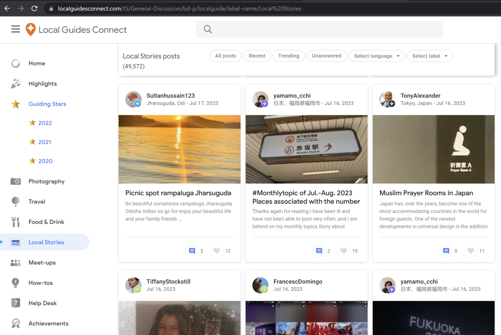
(1) Browsing The Library of Local Guides, or the Wikipedia of Places
- What you need:
- A Google account
- A web browser (recommended)
- Ability to navigate websites independently
- What you can do:
- Browse, analyze information and ideate on a topic about places, e.g:
- Analyze child-friendly areas on Google Maps within your neighborhood and make a proposal to improve a specific area.
- Make a tour to a certain place and ask other students to rate and review it on Google Maps. This way, everyone benefits from the reviews.
- Browse, analyze information and ideate on a topic about places, e.g:
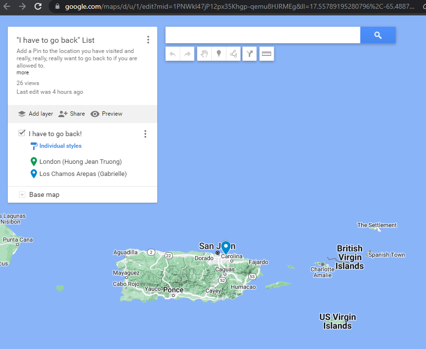
(2) Creating knowledge collection with Google Map Pins
- What you need:
- A Google account. Web browser only
- Learners should have ability to self-navigate a map and a website.
- What you can do:
- Create a shared Google Map and throw a prompt to the class, e.g:
- A place that you want to visit again
- A place that you find most related/important in the world history
- The learners then use the shared Google Map to pin their responses to the prompt. They can include as much or as little detail as they want on their pin. This could be a brief note about their selection, an image, or a story about their experience. (We did this in our EME 6414 class!)
Optional:
The class can explore the map after everyone has pinned their preferred locations. Each participant has the opportunity to explain their choices, share their stories, or ask questions about other people’s pins, as well as discuss the similarities and differences in choices, or simply share more about their experiences.
- Create a shared Google Map and throw a prompt to the class, e.g:
(3) Discussing about data privacy or geography/culture uniqueness
- What you need:
- A Google account. Instructor needs to present video/photos.
- Learners should have prior knowledge about data privacy or knowledge about a certain places.
- What you can do:
- Present a random photo on Google Maps and invite learners to deduce as much information as possible about the location.
- Invite students to watch a series of YouTube videos as below, discuss how to identify the specific location on Google Maps and draw implication on data privacy.
Those are my ideas for now, and I’m eager to hear yours. What’s your “Google Maps for learning” idea?
